June Lake Loop
The Glacial Lake Loop
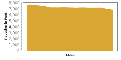
| Mileage | 15 miles (25 km) |
|---|---|
| DurationThe duration is an estimate of a one-way drive and does not include any stops or side-trips. | 22 minutes |
| SeasonsThe seasons listed are the best seasons for this scenic drive. If Winter is not mentioned, the road may be closed during the winter. | Spring, Summer, and Fall |
| Roadways | California Highway 158 |
| ServicesThe cities or towns listed have either Food or Services such as gas, pharmacies, etc. | June Lake, CA▼, June Lake Junction, CA▼, and Lee Vining, CA▼ |
| Rating | 4.0 average from 43 votes |
| My DrivesTrack your favorite scenic drives by selecting those which you want to take and those that you have taken. Using your free account, simply sign in and select My Drives. | |
| Share |
Our free Road Trip Planner will reverse the route and include the places of interests. Click the “Add to Road Trip” above to start planning your next road trip.
Send this link to your phone. Standard text messaging rates apply.
() -Get directions from your start address to the beginning of and including this scenic drive. Choose either an alternate ending or same as start.
Have more destinations? Use our free Road Trip Planner to completely plan your adventure. Click the “Add to Road Trip” above to start planning your next road trip.

During the last ice age, glaciers moving over this region helped form the magnificent shape of the mountains, valleys, rivers, and lakes that the June Lake Loop travels through.

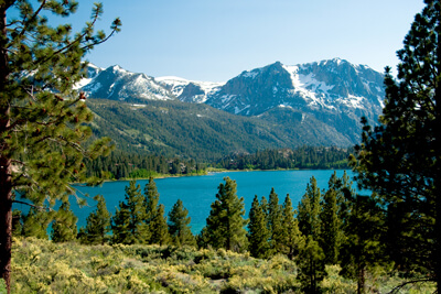
Starting from the southern part of the loop from US-395, head west on June Lake Loop. You will soon arrive at June Lake (W1) and Gull Lake (W2) which beautifully mirror the surrounding rugged mountains of the Eastern Sierra. Enjoy a picnic or take in some of the many water activities — boating, fishing, water-skiing or windsurfing. To the southwest, you will see Carson Peak in the distance. On the west end of June Lake, keep an eye for the two boulders on top of each other; these were naturally left behind as you see them by glaciers.
Continuing west, the road will veer north. For a side trip with a great view, head west on Rush Creek Substation Road and turn right onto the next road which will bring you to Agnew and Gem Lakes. These two lakes are nestled within the mountains and their elevation offers a stunning view of the valley below.
Continuing north on June Lake Road, you will pass Silver Lake (W3) on the right. In addition to being one of Sierra’s oldest fishing resorts, the Rush Creek Trailhead to the north of the lake provides access to the Rush Creek Basin, the Ansel Adams Wilderness and Yosemite National Park.
Shortly after Silver Lake is Grant Lake (W4), the largest of the four lakes on the June Loop. It is known for its fishing and population of great blue herons.
The drive ends as you join US-395. From here, consider heading north on US-395 to Mono Lake (W5) or Yosemite National Park.
Other Nearby Places of Interests
Lee Vining Forest Ranger Station (I1)
Mono Basin National Forest Scenic Area Visitor Center (I2)
Agnew and Gem Lakes (W7): Nestled in the mountains, Agnew Lake and Gem Lake are man-made lakes used as reservoirs and features fishing, boating, beach access, and hiking. To access, turn west onto Rush Creek Substation Road and turn right onto the next road.
Cathedral Lakes (W8): A 7-mile hike to Cathedral Lake offers breathtaking views of the wilderness and ends with lakes surrounded by mountain peaks towering over 10,000 feet.


